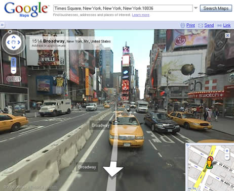
Google Street View
Google Street Viewis a feature in Google Mapthat allows users to explore streets around the world in a 360-degree panoramic view. It was first launched in the United States on May 25th, 2007. Now it is developing at a rapid rate in different countries around the world. This technology lets people check out travel sites, restuarants, neighborhoods from different angles, in a multi-dimentional view. The images in Google Street View are captured by cars specially adapted with cameras and antennas, also by tricycles and snowmobiles at places where cars cannot easily access.
Contents
Timeline
Processing Imagery
Google Street View is first created by collecting photographs of desired locations, which is done by moving vehicles equipped with cameras and antennas. While capturing pictures, photographers need to pay close attention to the position of the sun, so the contour of the landmarks do not blur in the shadows. They also need to consider other factors like weather and temperature.
Photographers plan to collect images starting with places that tend to be more populated and important.
Turing Photographs into Street View
Multiple cameras on the vehicles take overlapping picture, so there are no gaps in the 360-degree Street View. Each picture is analyzed on the angle and distance that it was taken from, then the separate photographs are pieced together into an unified panorama like the pictures below.
Separate photographs:
Unified panorama:
Google Street View as users see it:
Area of Coverage
Technology
Ethical Dilemma


