File:Covid19GoogleMaps.png
From SI410
Size of this preview: 800 × 324 pixels. Other resolution: 320 × 130 pixels.
Original file (850 × 344 pixels, file size: 113 KB, MIME type: image/png)
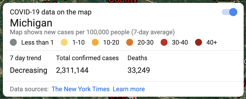
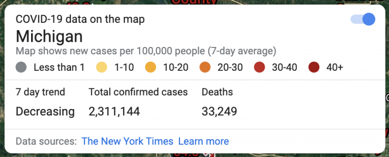
The COVID-19 Layer Offered by Google Maps
File history
Click on a date/time to view the file as it appeared at that time.
| Date/Time | Thumbnail | Dimensions | User | Comment | |
|---|---|---|---|---|---|
| current | 12:06, 11 February 2022 | 850 × 344 (113 KB) | Eofiara (Talk | contribs) | The COVID-19 Layer Offered by Google Maps |
- You cannot overwrite this file.
File usage
There are no pages that link to this file.