Difference between revisions of "Google Street View"
| Line 167: | Line 167: | ||
==Japan Tsunami Archive== | ==Japan Tsunami Archive== | ||
| − | |||
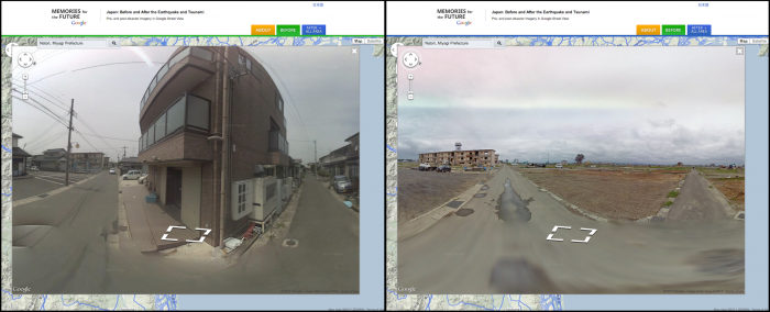
On December 12, 2011, Google announced on their [http://googleblog.blogspot.com/ official blog] that they have digitally archived over 44,000 km of Japan destructed by the March, 2011 tsunami.<ref name="gblog">http://googleblog.blogspot.com/2011/12/experience-tsunami-affected-areas-of.html</ref> This initiative will not only help researchers, scientists, and historians understand the widespread effects of such a powerful natural disaster, but it will also help those across the world who would otherwise never have a chance to see the tsunami's damage first hand. Google also released image timestamps, "the most requested feature of Street View for the past few years."<ref name ="gblog" /> Timestamps are visible at the bottom of a Street View image. | On December 12, 2011, Google announced on their [http://googleblog.blogspot.com/ official blog] that they have digitally archived over 44,000 km of Japan destructed by the March, 2011 tsunami.<ref name="gblog">http://googleblog.blogspot.com/2011/12/experience-tsunami-affected-areas-of.html</ref> This initiative will not only help researchers, scientists, and historians understand the widespread effects of such a powerful natural disaster, but it will also help those across the world who would otherwise never have a chance to see the tsunami's damage first hand. Google also released image timestamps, "the most requested feature of Street View for the past few years."<ref name ="gblog" /> Timestamps are visible at the bottom of a Street View image. | ||
[[File:japanbeforeafter.png|thumb|left|700px|Before and after pictures of the tsunami destruction in Japan via [http://www.miraikioku.com/streetview/en/ Memories for the Future]]] | [[File:japanbeforeafter.png|thumb|left|700px|Before and after pictures of the tsunami destruction in Japan via [http://www.miraikioku.com/streetview/en/ Memories for the Future]]] | ||
Revision as of 00:44, 12 December 2012
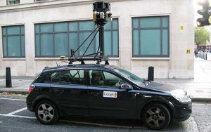
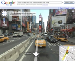
Google Street View is a feature in Google Maps and Google Earth that allows users to explore streets around the world in a 360-degree panoramic view. First launched in the United States on May 25th, 2007, it is now developing at a rapid rate in different countries around the world. This technology lets people check out travel sites, restaurants, neighborhoods from different angles, in a multi-dimentional view. The images in Google Street View are captured by cars specially adapted with cameras and antennas, tricycles, and even snowmobiles in certain areas not accessible by car. In 2008, Google Street View was added to the Google Maps application, enabling iPhone users to use Google Street View from their phones. Google Street View has recently been the subject of online data collecting issues and privacy issues. [1].
Contents
Timeline of Key Additions
| Date | Key Development |
|---|---|
| December 25, 2007 | Google lauches Google Street View |
| May 12, 2008 | Google first announced its success with testing face-blurring technology on its photographs of the streets of Manhattan. |
| April 16, 2008 | Google Street View became a part of Google Earth 4.3 |
| July 2, 2008 | Google Street View goes outside of United States for the first time, and introduced the 4th Generation Cameras. |
| August 4, 2008 | 48 iconic scenery of metropolitan areas in Australia, Japan, and America made its debut. |
| November, 2008 | Street View button is deleted, and now accessed through the "pegman" icon on the upper left hand corner, which can be dragged to change angles of the image. |
| December 1, 2008 | Google took New Zealand Privacy Commission's suggestion and blurred people's faces, but not the registration plate on vehicles. |
| April 9, 2009 | Google Street View now available in full screen option |
| June 5, 2009 | Introduction of the Smart Navigation |
| April 1, 2010 | Google Street View now available in 3D. |
| June, 2010 | Google inserted blue dots on Google maps to display user-submitted images from all over the world. Areas include places where Google Street View is not yet available. |
| December 12, 2011 | Google follows through in their initiative to digitally archive the regions of Japan that were affected by the March, 2011 tsunami. The month and year of when the photo was taken is now included at the bottom of the image. |
| January 14, 2012 | In order to promote the newest version of Google Earth, those who used versions lower than 6.0 were blocked from seeing Street View. |
Processing Imagery
Google Street View is first created by collecting photographs of desired locations, which is done by moving vehicles equipped with cameras and antennas. While capturing pictures, photographers need to pay close attention to the position of the sun, so the contour of the landmarks do not blur in the shadows. They also need to consider other factors like weather and temperature.
Photographers plan to collect images starting with places that tend to be more populated and important.
Turning Photographs into Street View
Multiple cameras on the vehicles take overlapping pictures so there are no gaps in the 360-degree Street View. Each picture is analyzed on the angle and distance that it was taken from. Then the separate photographs are pieced together into a unified panorama like the pictures below.
Separate photographs:
Unified panorama:
Google Street View as users see it:
Technology
Images are captured primarily by specially fitted vehicles that drive around collecting images. Imaging trips are carefully planned in terms of time of day, time of year, and weather. There can be no snow, fog, rain, or shadows because that will skew the images. They also take into account traffic so as to utilize their time most efficiently.
In order to determine which images align with which addresses, they use signals from sensors around the imaging vehicle, GPS, as well as speed and direction monitors. Additionally, they use image blurring software to make sure pedestrians' faces and vehicles' license plates are not visible. [2]
Areas of Coverage
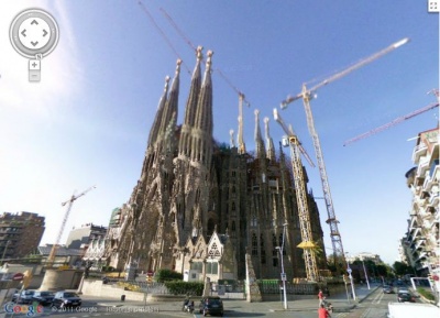
The below is a table of the continents and year of the country added to Google Street View
| Continent | Country | Year added |
|---|---|---|
| North America | United States | 2007 |
| Canada | 2009 | |
| Mexico | 2009 | |
| South America | Brazil | 2010 |
| Europe | Belgium | 2011 |
| Czech Republic | 2009 | |
| Denmark | 2010 | |
| France | 2008 | |
| Finland | 2010 | |
| Germany | 2010 | |
| Ireland | 2010 | |
| Italy | 2008 | |
| Isle of Man | 2011 | |
| Jersey | 2011 | |
| Monaco | 2011 | |
| Netherlands | 2009 | |
| Norway | 2010 | |
| Portugal | 2009 | |
| Romania | 2010 | |
| Russia | 2011 | |
| Spain | 2008 | |
| Sweden | 2010 | |
| Switzerland | 2009 | |
| United Kingdom | 2009 | |
| Asia | Hong Kong | 2010 |
| Japan | 2008 | |
| Macau | 2010 | |
| Malaysia | 2011 | |
| Singapore | 2009 | |
| Taiwan | 2009 | |
| Thailand | 2011 | |
| Australia | Australia | 2008 |
| New Zealand | 2008 | |
| Africa | South Africa | 2009 |
| Antarctica | Antarctica | 2010 |
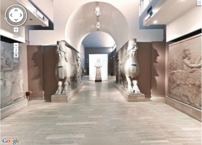
| Middle East | Iraq | 2011 |
Japan Tsunami Archive
On December 12, 2011, Google announced on their official blog that they have digitally archived over 44,000 km of Japan destructed by the March, 2011 tsunami.[3] This initiative will not only help researchers, scientists, and historians understand the widespread effects of such a powerful natural disaster, but it will also help those across the world who would otherwise never have a chance to see the tsunami's damage first hand. Google also released image timestamps, "the most requested feature of Street View for the past few years."[3] Timestamps are visible at the bottom of a Street View image.
Ethical Dilemmas
As Google's Street View project continues to progress, it continues to face a variety of legal barriers and a large public outcry over ethical issues. Some individuals praise the newest technological innovation by Google for its convenience it has created. On the other hand, there are people who claim it violates an individual's right to privacy. There has been comparisons between George Orwell's "1984" and Google Street View - when looking at the specifics, how different are the two situations? For Google Street View the public owns the information and has full access to it, while in "1984" the public was being examined without any access to the data that was being collected.
Data Collection and Use
In June of 2011, a federal judge ruled that Google could be held responsible, and sued, for secretly collecting data on open WiFi Networks. [4]. Google became aware of their data collection after an audit was requested by Hamburg, Germany's data protection authority and have since ceased their wifi collection. In May 2007, Google unveiled Google Street View, a street-level photographic mapping that allows users to see a 360 degree view of whatever happened to be there at the time the photographs were taken. Predictably, some people have been upset to find themselves displayed in awkward or embarrassing positions, and in some cases, faces, license plates, and the interiors of houses and stores can be seen. Some privacy advocates are lobbying for Google to obscure faces, license plates, and interiors in the pictures, even though the process is laborious and time consuming. [5]
Privacy Issues
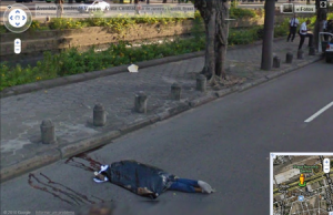
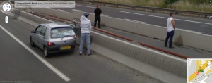
It is a relatively new technology and people are beginning to incorporate it into their daily lives. Even though Google Street View has the purpose of providing users a realistic and visual appealing panoramic view of geographic areas, many privacy concerns were raised at some of the photos taken by the Google vehicles. Most of the concerns are based around the idea of capturing images of people without their consent. Even though faces cannot be clearly identified, people may not like their current locations to be revealed through these images. Some people may not like to be photographed for example members of crowds at political protests, women sun-bathing out on their lawns, or men coming out of strip clubs. In addition, many are upset at the fact that Google Street View can assist people in illegal activities. For instance, burglars can scope out a house to rob from the comfort of their own home, eliminating the risk of being caught staking out. There are many instances where Google Street View has caught inappropriate or illegal behavior amongst people. Such behaviors include vandalism, reckless driving, burglary, prostitution, and other unethical activities. Google also had taken pictures of public nudity and murders, in which they had been removed after the they had been reported by people, such as the instance of the dead bodies found in Brazil's Google Street View.[6]
There have been some attempts made to address this issue. Google Inc. has made efforts to address the privacy concerns by offering a "help" button next to all the public pictures that allow users to request removal of controversial pictures taken. [7]
It stands to reason that eventually, for security reasons, unlawful activity documented on Google Street View may be able to be used as evidence for prosecution against the accused individual. As technology improves, the cameras will be able to capture more and more detailed images, providing an increasingly appealing way to catch unlawful activity.
Strange Images
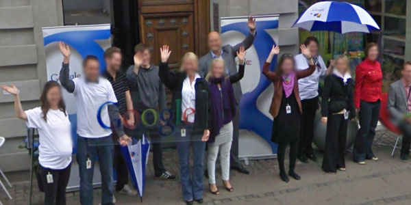
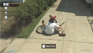
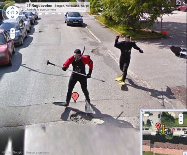
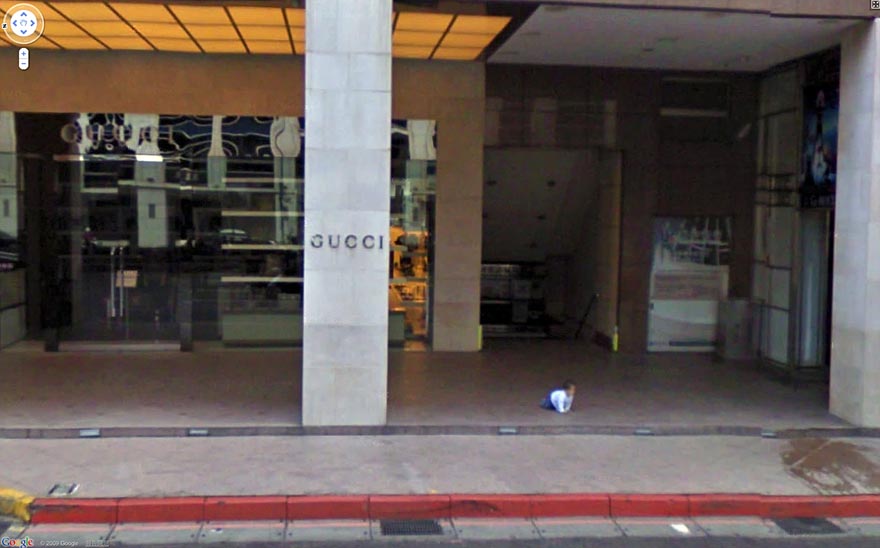
Because Google's Street View collects photos via driving down the street, they often catch strange, silly, and funny photos. Many people often see the google street view car driving down the street (since it is vibrantly and explicitly painted) and instantly snap into funny poses, waves, or occasionally elaborately planned schemes meant to be found and laughed about later.
The following photos are some examples: Employees at Google Denmark were prepared for their photo:
Bike accident in Idaho:
Scuba Steve is after you in Norway:
Lost Baby
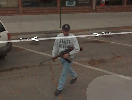
Think he is going hunting?
See Also
References
- ↑ Google Street View. Wikipedia. Retrieved 6 December 2011.
- ↑ http://maps.google.com/help/maps/streetview/technology/photos-into-street-view.html Retrieved 21 November 2011.
- ↑ 3.0 3.1 http://googleblog.blogspot.com/2011/12/experience-tsunami-affected-areas-of.html
- ↑ Kravets, David. "Judge: Google Can Be Sued for Wiretapping in Street View Debacle". Wired Magazine. June 30, 2011. Web.
- ↑ McMillan, Robert. "Google stops sniffing Wi-Fi data after privacy gaffe". Computerworld March 14 2010. Web.
- ↑ http://techcrunch.com/2010/10/01/google-street-view-brazil/
- ↑ Google. (2011). Corporate information. Retrieved from http://www.google.com/about/corporate/company/


